Black Friday... and another 10 mile hike (with one "black" downside only - Di's walking stick broke).
The weather was predicted overcast but without wind and no rain until this evening - Perfect for hiking.
We liked where we are staying and the guest house has enough space. A photo from the outside with our car parked. Our window is top floor far right, right of the drainpipe. Very quiet.
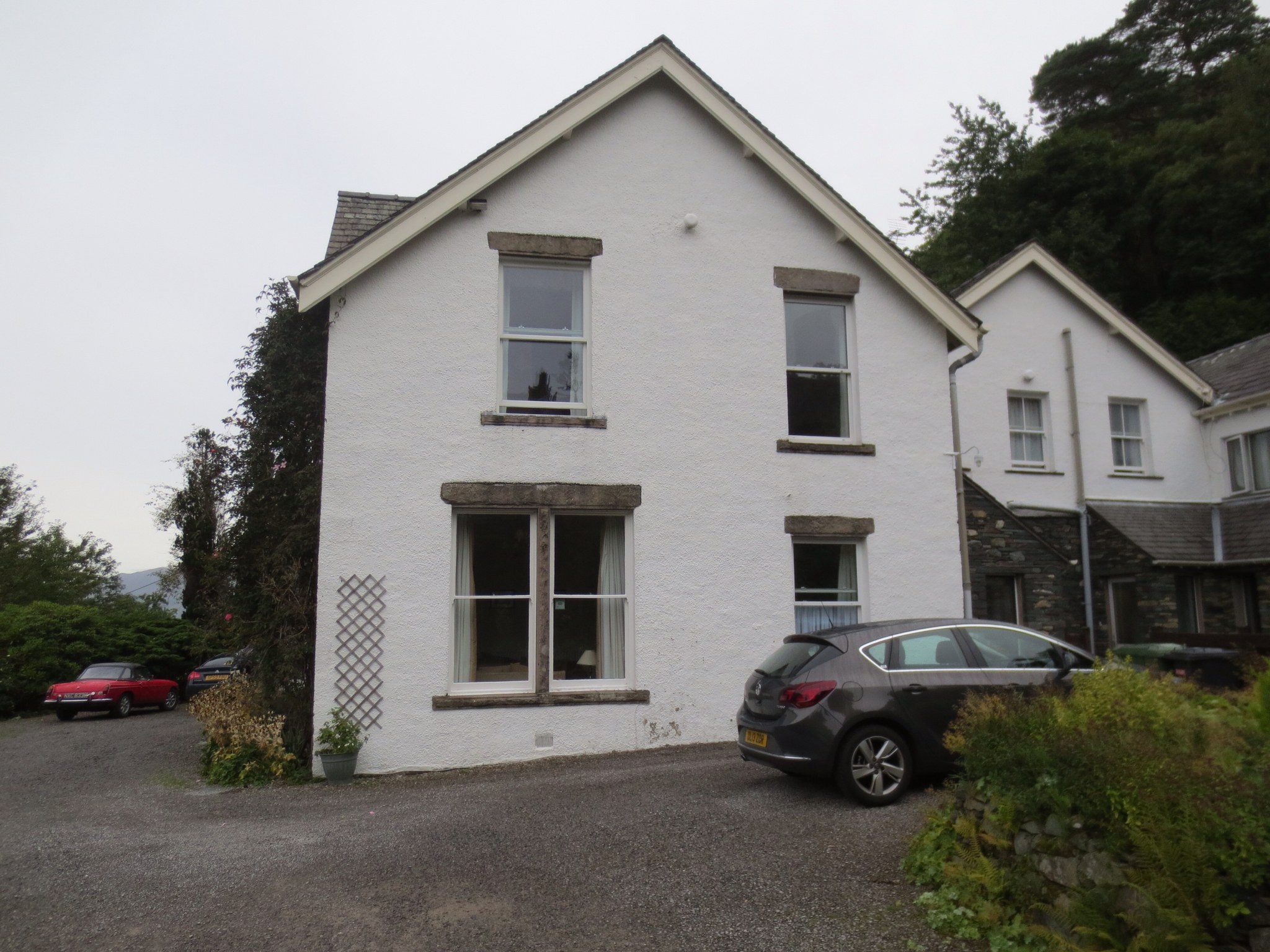
The only quirks here seem to be in the bathroom...no shower, just a handheld, no shower curtain so water can go everywhere, but with a carpeted floor (which is often damp as a result) and an electrical heated towel rail suspended over the bath tub (in case you feel suicidal?). All a bit strange.

But we forgave them as the rate we are paying seems to be on average about £25 - £30 cheaper per night than the going price in the Lake District AND the heated towel rail is perfect for drying hand washing overnight.
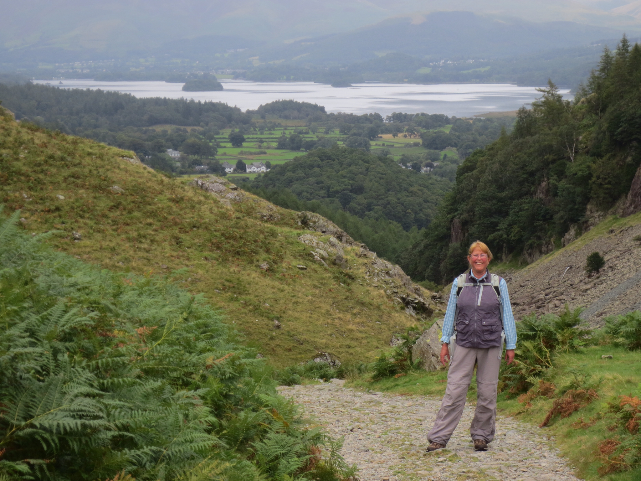
We set off for our walk today a little later, at 8.30am, having tried some repairs to Di's broken hiking pole, which unfortunately failed.
The beauty of starting "early" (by English standards) is that we again found we had the trail to ourselves for the first few hours. It tends to get busier around 11am. And today's combination of 3 trails were again really lovely and interesting. And no need to drive the car to anywhere to start the hike again which of course is a great bonus.
This was how it panned out...

We started with a trail from High Ladore over the ridge behind where we are staying into a different valley called Watendlath. This was a bit of a challenge first up with a steep rocky climb of 200 metres, then a gradual ascent up the valley. Di was a bit steamy by the top... (Not just here... (Hans note))

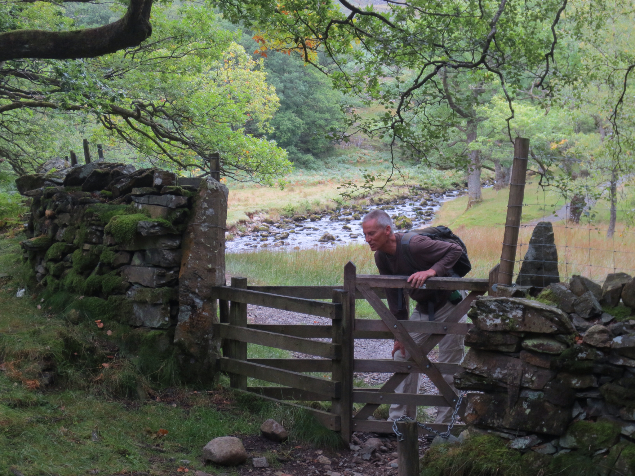
Hans is here demonstrating why these are called "kissing gates".
Lovely scenery, lots of creeks and waterflows with many bridges across. This hike has a unique directional marker at a 3-way junction - a metal triangle in the ground. We went right.

Walking on the old packhorse road...

On the way to Watendlath. It was relatively easy walking this stretch as the climb was very gradual.

Self portrait looking back to where we came from.

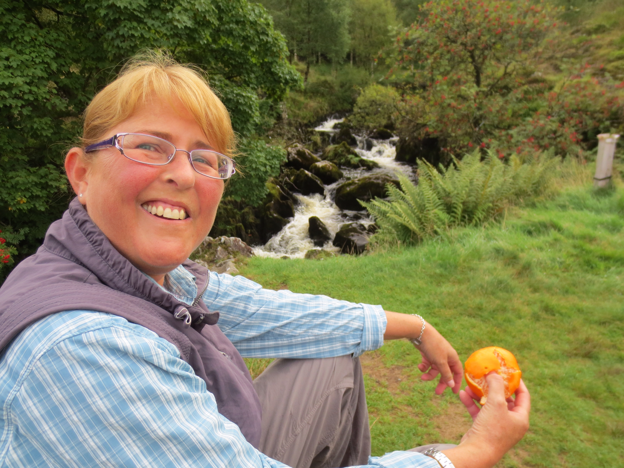
First break by a lovely creek. We still hadn't seen one single other person on the trail.
Then we arrived at the little hamlet of Watendlath with its very peaceful and idyllic tarn unsurprisingly called Watendlath Tarn. Two guys fly fishing, standing in their boats, made it picture perfect.

It was up up up again for a while until we reached the top and then of course it was down down... Rosthwaite can be seen down there to the left of Hans. We were heading there but we took our time, as it was a steep rocky track. Di kept muttering about "no pole" but considering she has walked everywhere else without one she coped OK. Just whinging...

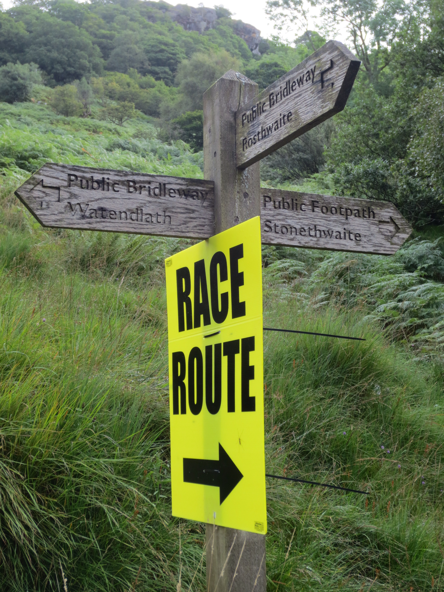
This was an unexpected sudden sight on the track. We had seen signs about Tour of England bicycle race before, and a lovely lady hiker who we met just here filled us in with the details. Apparently, Tour of England in addition to the on-road race has a race for off-road mountain biking. The race would take place on Monday, 3 days after we were here.

The footpath signs had been given a temporary addition. We were really pleased to be walking the track before this race as it would certainly create more bog factor.
We can't rave enough of how much of an additional luxury it is to have a tea break during a hike. We had to walk through the hamlet of Rosthwaite anyway, so why not stop for a cuppa? After all, at this time, we were some 2 hours and a bit into our hike. Very nice and civilized, not silver service this time, just mugs of tea sitting outside (probably for the best considering our muddy attire)

English sense of humour around the corner of the tea house. Of course it is the entrance to the little loo.

After refueling, we continued hiking, heading a bit south past the front door of Borrowdale YHA and into Johnny's Wood.
We have been following instructions from a small handbook borrowed from our guest house on Short Walks in the area. We were linking 3 hikes (to get 10 miles total) and this was our second hike to the Borrowdale Terrace. All good until the track got a bit narrow and rocky and scrambling was required. Fortunately, chains were supplied for hand holding...but only on the first section. Then you were on your own.
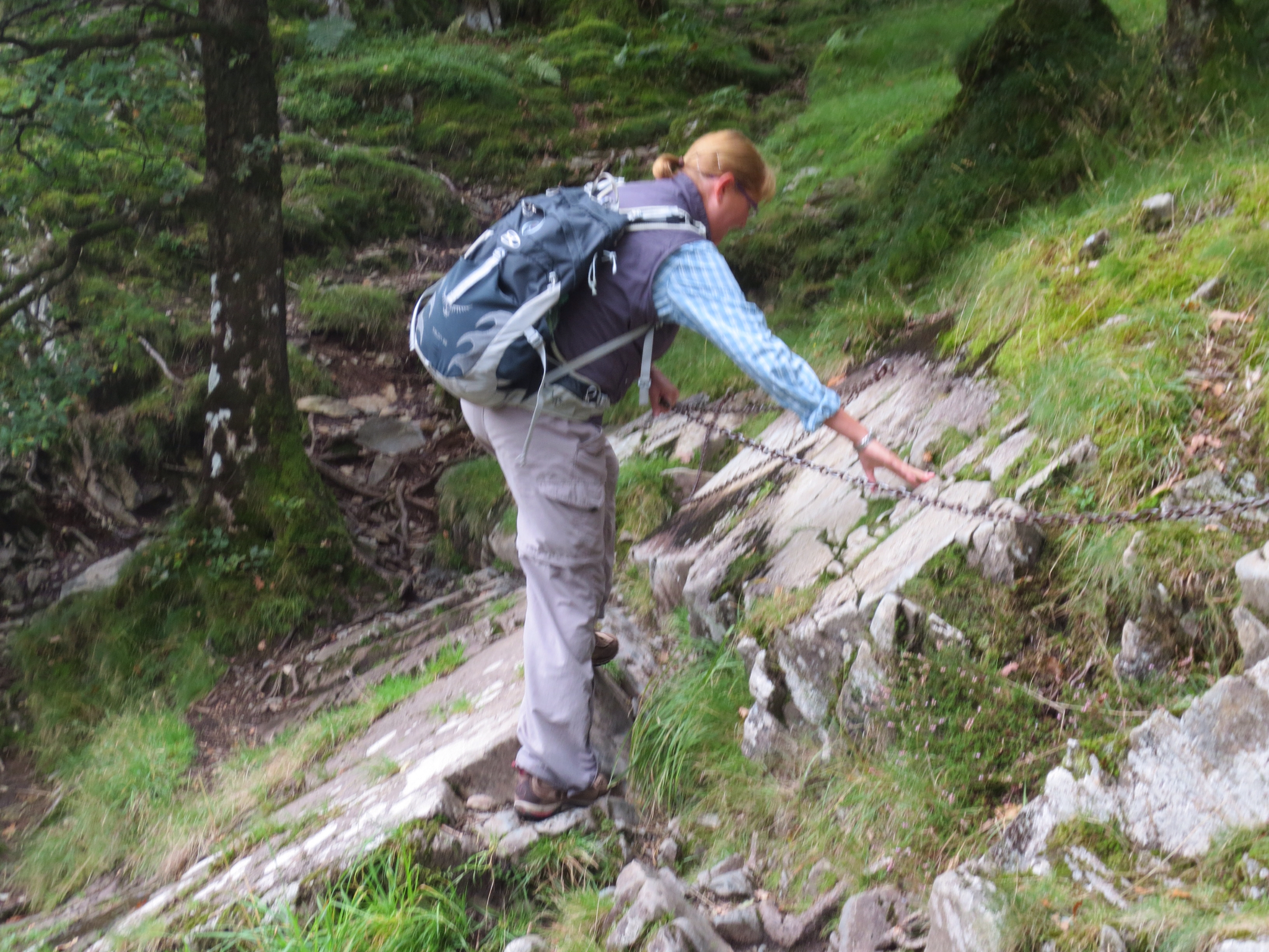
The right path...?
We planned to hike the Borrowdale Terrace following the trusty Short Walks handbook, which to date had been spot on but here the book let us down...
Green, green and more green. We ended up figuring out (afterwards) that we didn't actually need to bush bash here as there was a perfectly available farm path a bit further on but the book said...
Up up up the hill... Hill walking at its best...hard to see from this photo but it was very steep. Di steamed up again.

Look, no hands...

These stonewalls just looked great. Whatever happened to straight lines?

So far our hiking had been slow for 2 reasons - great views and also the taking time to read detailed instructions in our Short Walks book as there are so many trails.
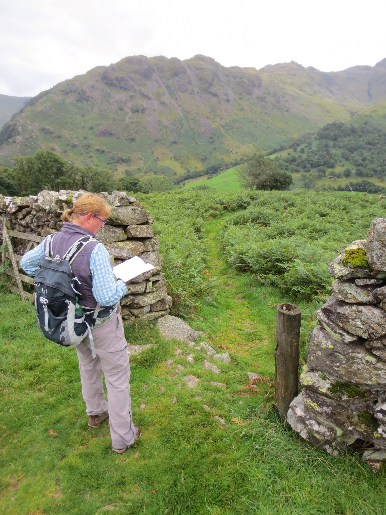
Di consulted the hiking book again as the trail and instructions did not match, so around this time we stopped paying attention to the "trusty book". It seemed that the book was referring to a trail that was not very well patronized and therefore had more or less grown over. Never mind, we could not miss the general direction of where we needed to go as there were multiple landmarks to refer to that we could see most of the time (road, river, hills etc).
We took a break for lunch when we reached a wider path which looked like an old road and we headed north as we knew at some stage there must be a path going down again. In the picture here the "path" we had taken was on the upper right, over the crag and down the hill. Others had walked this path, but not many and it was not obvious.

During our break though quite a few people came past on this, for us, new and unknown path, and in fact there was another couple doing their "outdoor cafe lunch" just on the other side of the wall (their words).
We worked it out - we had accidentally stumbled onto the Seetoller/Castle Crag route which is very popular and well published and hence more travelled. Interesting (for us) was that most of the people we met were much older than us - lots of tough women hikers in their late 60's and 70's and one senior couple who were also "Peaks Park Rangers". They were super fit as Peaks District is a national park with lots of hills, hence the name...d'uh and they walk the trails. Very inspiring for us in 10-20 years time.
After lunch we continued northwards and found Castle Crag - this is it. We are not sure that it deserves its popularity, it was not as high as where we had already been earlier today and we couldn't see how it offers any better views.

Perhaps Castle Crag was popular because it can be reached from both sides by the old toll road which is a less steep climb, stable underfoot with big rocks and almost impossible to miss.
Then we were on the homeward stretch, down the old toll road towards Derwentwater that you can see in the background and the hamlet of Grange where we had lunch the other day. Pretty easy going after our earlier stretches today.
Back to base around 2.30pm, with clean ups and bit of more washing utilizing the heated towel rails.
We decided on a night in, "gourmet" dinner from our bags of grocery goodies (and there was a lot of choice), a glass of wine or three and just chilling. Good night.
No comments:
Post a Comment